Danakil Depression Pictures, Images and Stock Photos
Browse 1,200+ danakil depression stock photos and images available, or search for the danakil depression or danakil depression ethiopia to find more great stock photos and pictures.
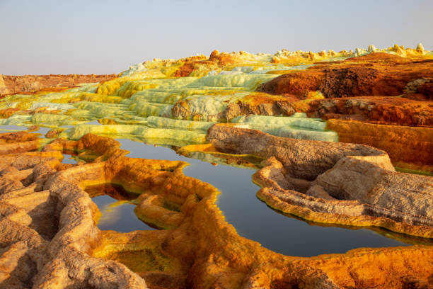
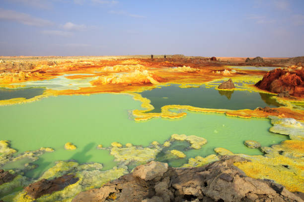
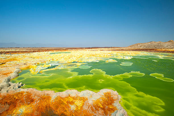
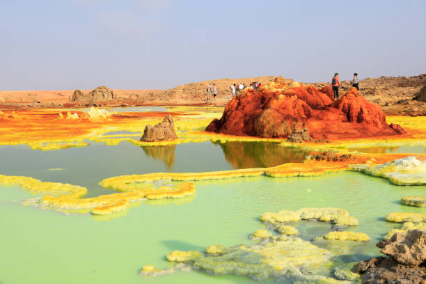
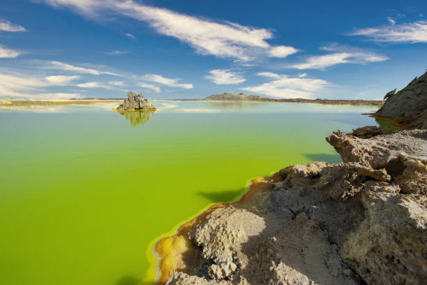
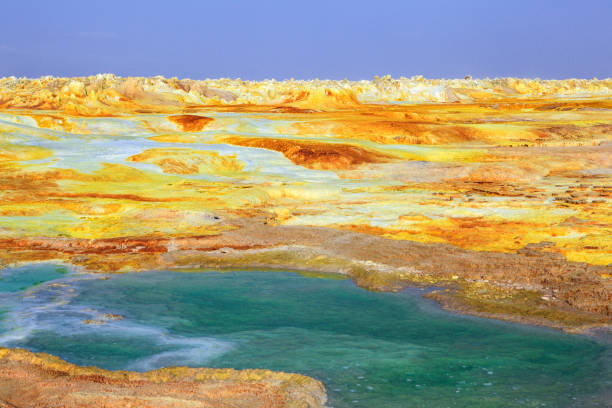
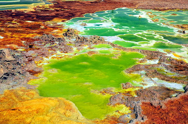
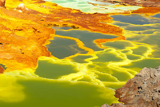
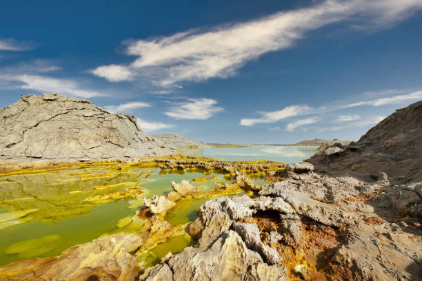
Acid ponds in Dallol site in the Danakil Depression in Ethiopia in Africa.
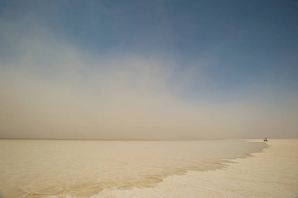
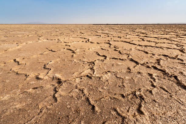
Extraordinary landscape - blue sky, white soil

Danakil depression landscape with red formations and sour river. Sulfur, salt and other minerals paint water in fantastic colors.
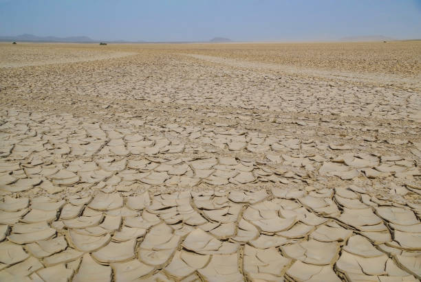
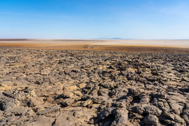
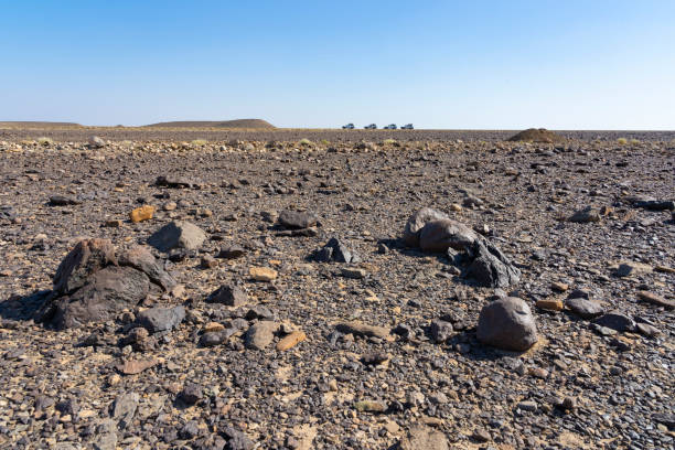
An African desert known for its extreme heat and inhospitality that is located in the Afar Depression, very close to the Red Sea. The deepest point of the desert reaches 100 meters below sea level.
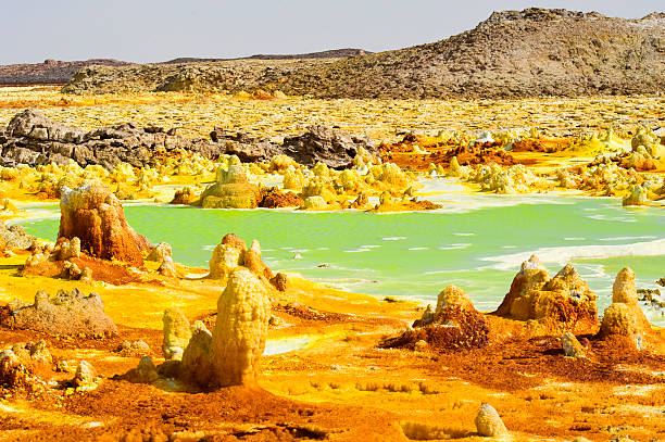
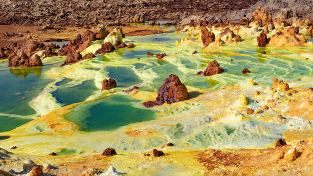
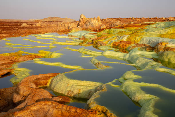
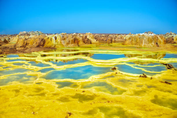
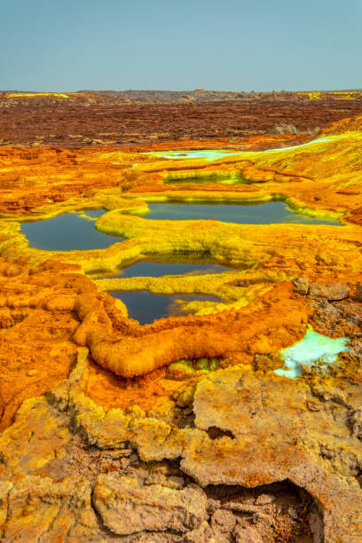
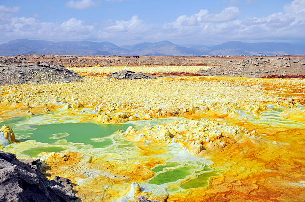
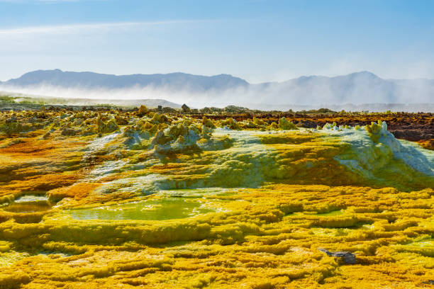
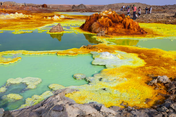
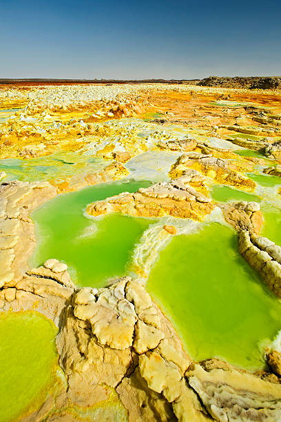
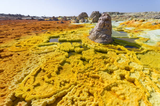
The volcanic explosion crater of Dallol in the Danakil Depresseion in Nothern Ethiopia. The Dallol crater was formed during a phreatic eruption in 1926. This crater is known as the lowest subaerial vulcanic vents in the world. The surreal colours are caused by green acid ponds and iron oxides and sulfur.
Out-this-planet view to Danakil Depression and sulfur, salt, potassium, calcium and ferrum mineral fields in hottest place on Earth
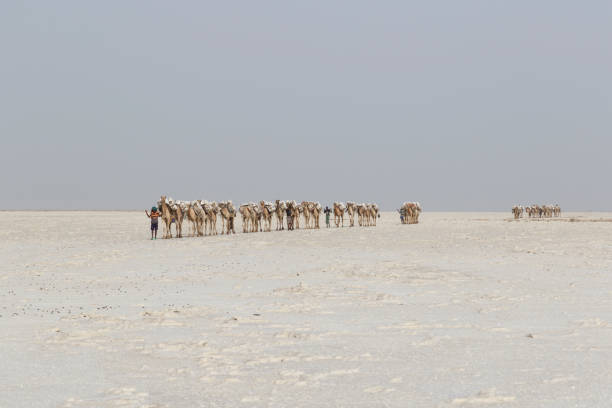
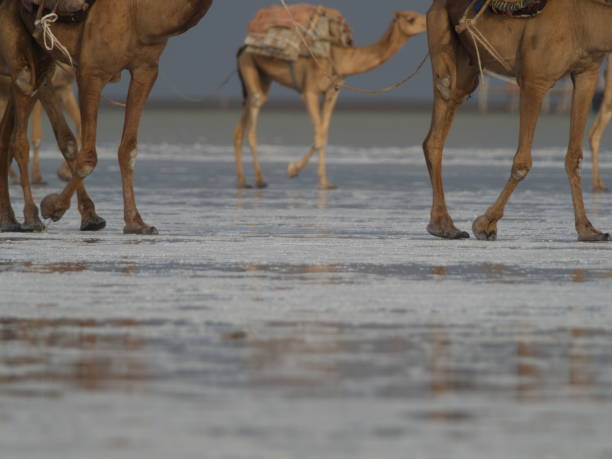
Danakil, Ethiopia, February 22 2015: Camels carry salt blocks in the hot and inhospitable Danakil desert to the next village in Ethiopia
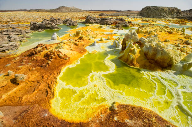
The volcanic explosion crater of Dallol in the Danakil Depresseion in Nothern Ethiopia. The Dallol crater was formed during a phreatic eruption in 1926. This crater is known as the lowest subaerial vulcanic vents in the world. The surreal colours are caused by green acid ponds and iron oxides and sulfur.
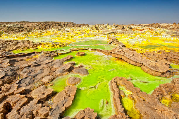
The volcanic explosion crater of Dallol in the Danakil Depression in Northern Ethiopia. The Dallol crater was formed during a phreatic eruption in 1926. This crater is known as the lowest subaerial vulcanic vents in the world. The surreal colors are caused by green acid ponds and iron oxides and sulfur.
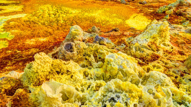
Dallol, Ethiopia - January 03, 2019: Yellowish green deposits which include potash, green acid and iron oxide, sulfur and salt desert plains, being also the hottest place on earth.
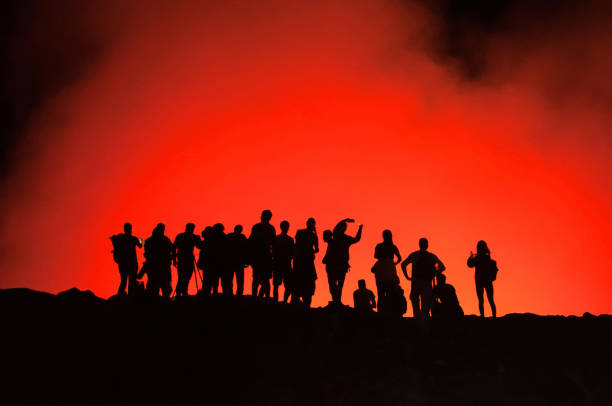
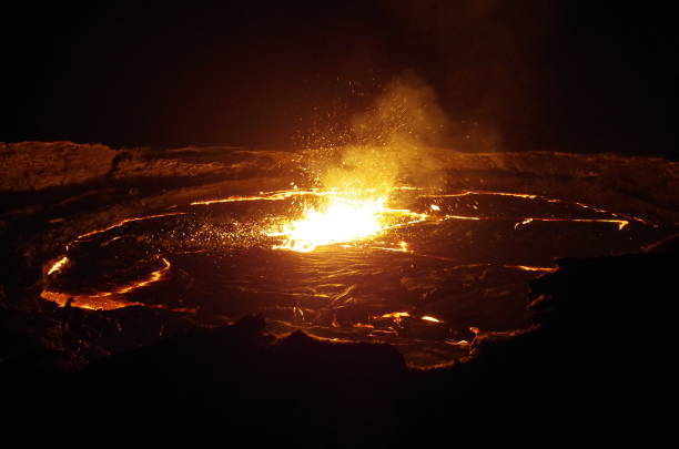
Active shield volcano, erupting at night in Danakil Depression in Ethiopia, impressive natural phenomenon
Out-this-planet view to Danakil Depression and sulfur, salt, potassium, calcium and ferrum mineral fields in hottest place on Earth

Dromedary (Camelus dromedarius) walking across desert at sunrise, bringing salt for sale from salt mining plain
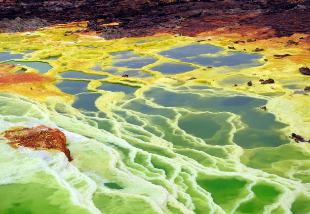
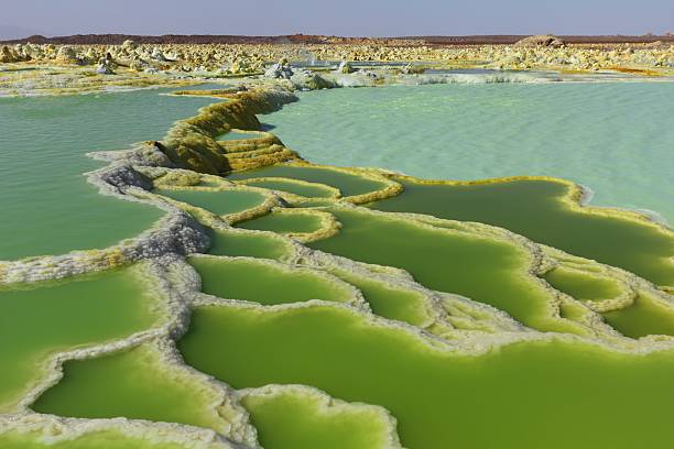
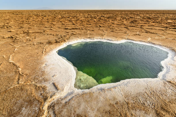
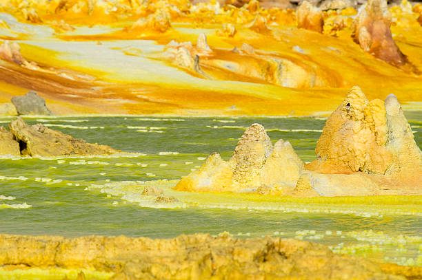
hot springs in the danakil depression with colourful mineral deposits
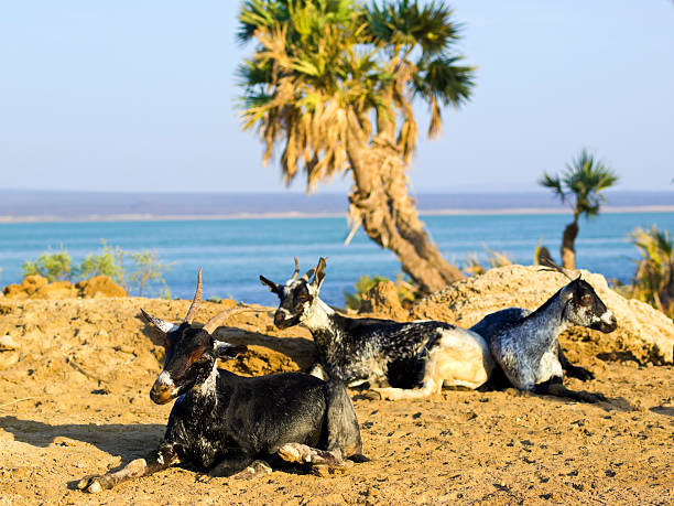
"Goats at Lake Afrera in background, which is a hyper saline lake with low pH and lot of salt foam on the sores in northern Ethiopiaaas Afar Region. It is in the Danakil Depression, desert and part of East African Rift. Lake is fed by underground streams. It has many names like Afdera, Afera, Giulietti and Egogi."
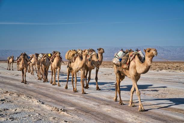
Afar Region, Ethiopia - January 3, 2019: Close up image of a camel caravan carrying salt from the Dallol salt mines on a hot day, in Afar Region, Ethiopia.
The volcanic explosion crater of Dallol in the Danakil Depression in Northern Ethiopia. The Dallol crater was formed during a phreatic eruption in 1926. This crater is known as the lowest subaerial vulcanic vents in the world. The surreal colors are caused by green acid ponds and iron oxides and sulfur.
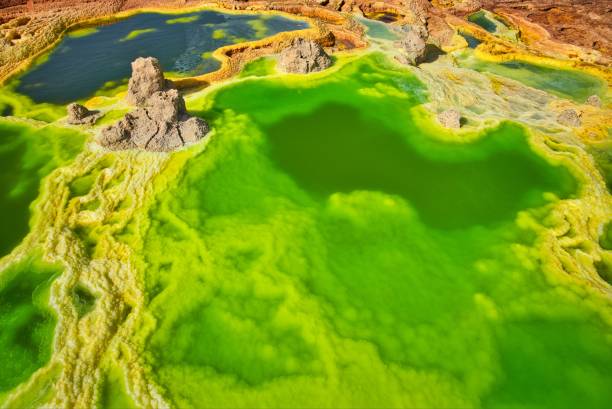
Dallol, Ethiopia - January 03, 2019: Yellowish green deposits which include potash, green acid and iron oxide, sulfur and salt desert plains, being also the hottest place on earth.
Out-this-planet view to Danakil Depression and sulfur, salt, potassium, calcium and ferrum mineral fields in hottest place on Earth
Salt structure close-up inside Dallol volcanic crater in Danakil depression Afar, Ethiopia
sulphur hot spring in the danakil depression
The Black Pool at Dallol in the Danakil Depression in Africa.
"Lake Afera Salt pans with some rural houses and Afdera volcano in background. Lake Afera is a hyper saline lake with low pH and lot of salt foam on the sores in northern Ethiopiaaas Afar Region. It is in the Danakil Depression, desert and part of East African Rift. Lake is fed by underground streams. It has many names like Afdera, Afera, Giulietti and Egogi."
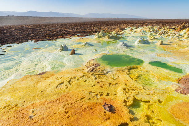
Acid ponds in Dallol site in the Danakil Depression in Ethiopia in Africa
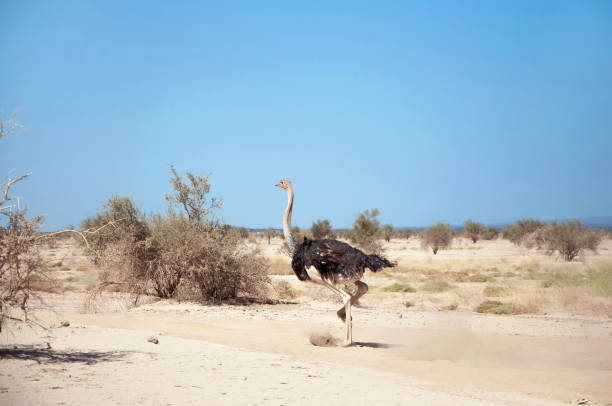
Male common ostrich (Struthio camelus) running through plain and dust clouds on the sunny day in Afar region
"**NOTE FOR INSPECTOR**: There is lot´s of sand in the air, so most of the grain is really sand of the coming sandstorm!A sandstorm at Ass Ale salt lake in the Dankali-Desert of Ethiopia, in the background a car could be seen.The Danakil Desert (or Danakil Depression) in the border-triangle between Ethiopia, Eritrea and Djibouti is one of the most remote and most extreme regions of the world - it is the lowest point in Africa (- 155 metres/-550 ft below sea level) and one of the hottest places on Earth. The Danakil/Afar Depression is the product of a tectonic triple junction, where the spreading ridges that form the Red Sea and the Gulf of Aden emerge on land and meet the East African Rift. Here the Earth's crust is slowly rifting apart at a rate of 1–2 centimetres (0.3–0.8 in) per year.About 1200 km² (463 sq mi) of the Afar Depression is covered by salt, and salt mining is still a major source of income for many Afar tribes - the largest salt lake is called Ass Ale, it is near the Dallol vulcano.See more of my pictures of the Danakil/Afar-Depression:"
Salt formations in the Danakil depression, ethiopia
Beautiful small sulfur lakes Dallol, Ethiopia. Danakil Depression is the hottest place on Earth in terms of year-round average temperatures. It is also one of the lowest places on the planet
The volcanic explosion crater of Dallol in the Danakil Depresseion in Nothern Ethiopia. The Dallol crater was formed during a phreatic eruption in 1926. This crater is known as the lowest subaerial vulcanic vents in the world. The surreal colours are caused by green acid ponds and iron oxides and sulfur.
Acid ponds in Dallol site in the Danakil Depression in Ethiopia in Africa
The volcanic explosion crater of Dallol in the Danakil Depresseion in Nothern Ethiopia. The Dallol crater was formed during a phreatic eruption in 1926. This crater is known as the lowest subaerial vulcanic vents in the world. The surreal colours are caused by green acid ponds and iron oxides and sulfur.

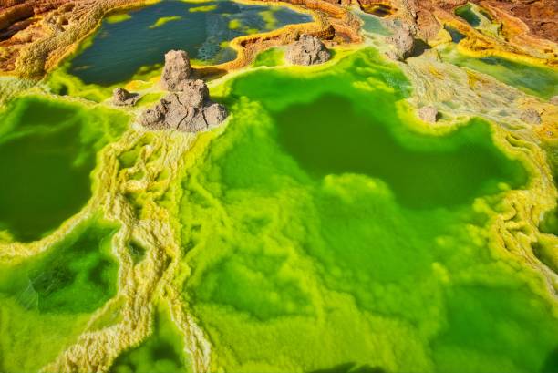
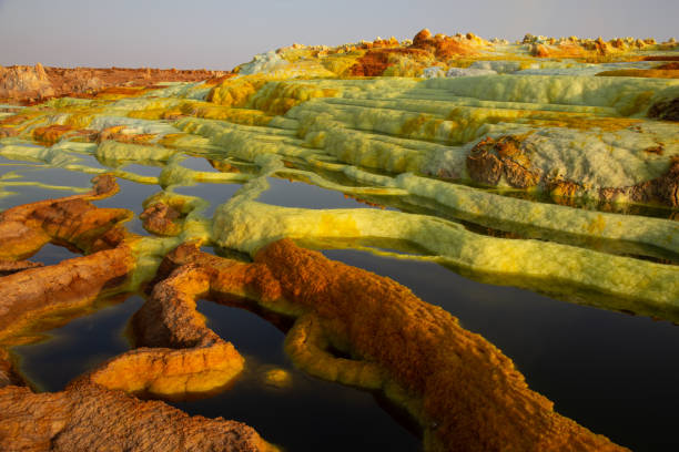
Dallol is known for its unearthly colors and mineral patterns, and the very acidic fluids that discharge from its hydrothermal springs.
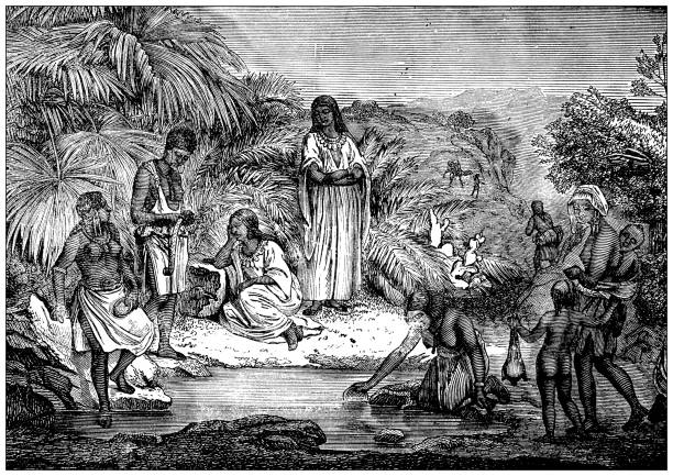
Antique illustration: Danakil women
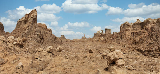
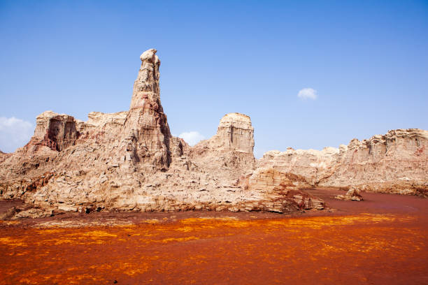
impressive rock formations rise in the Danakil depression like stone rock city. Landscape like Moonscape, Danakil depression, Ethiopia, Africa
Out-this-planet view to Danakil Depression and sulfur, salt, potassium, calcium and ferrum mineral fields in hottest place on Earth
Afar Triangle or Danakil Depression
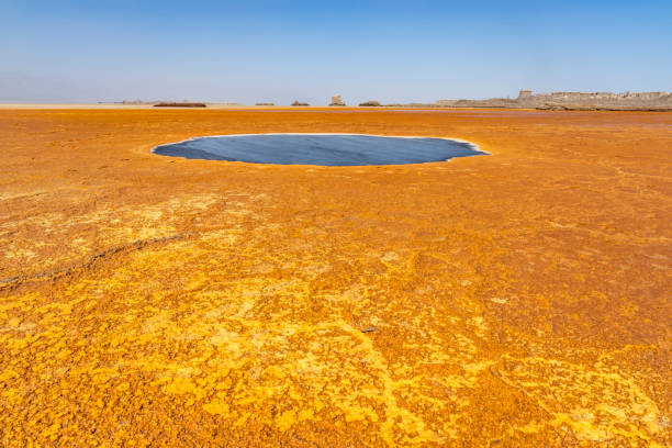
Salty area of Ass Ale lake, in the Danakil depression, Ethiopia
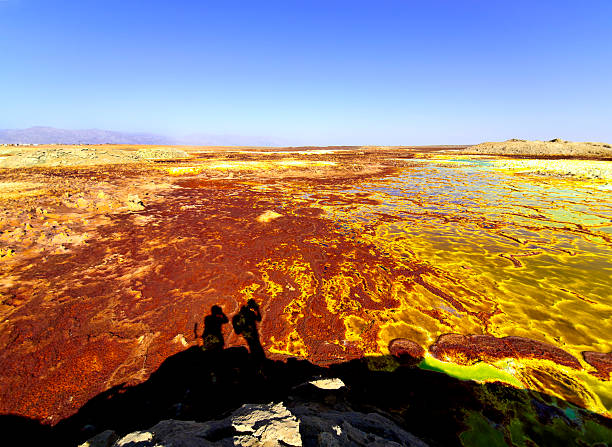
Two photographers at Volcanic remains after 1926 eruption as Hot Springs and geothermal / volcanic activity on Dallol Mountain. The characteristic white, yellow and red colours are the result of sulphur and potassium salts coloured by various ions. It is located in the Danakil Depression with the highest average temperatures on the planet and is considered the most remote and beautiful place on Earth, North East Ethiopia near Eritrea in Africa.
Afar Depression (Afar Triangle)
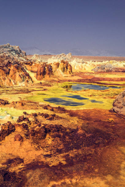
View of the Danakil Depression from Dallol in Ethoipia in Africa.
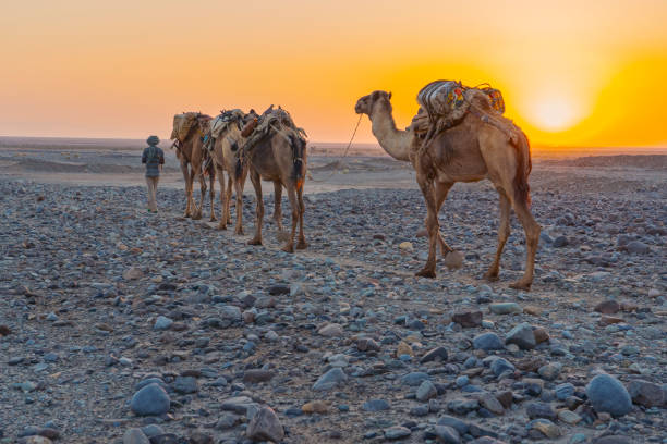
An Afar man leading a caravan of dromedaries transporting salt in the Danakil Depression in Ethiopia in Africa during winter season.
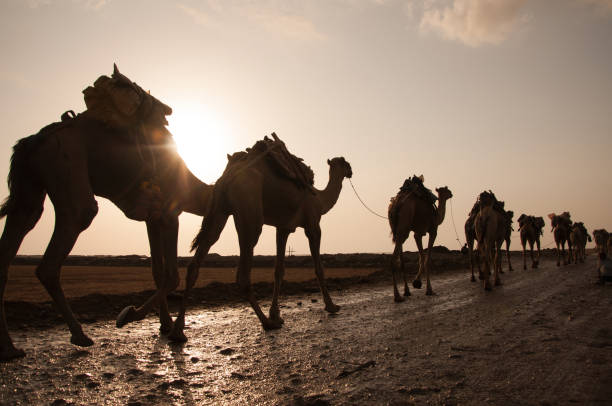
Dromedary (Camelus dromedarius) walking across desert at sunrise, bringing salt for sale from salt mining plain
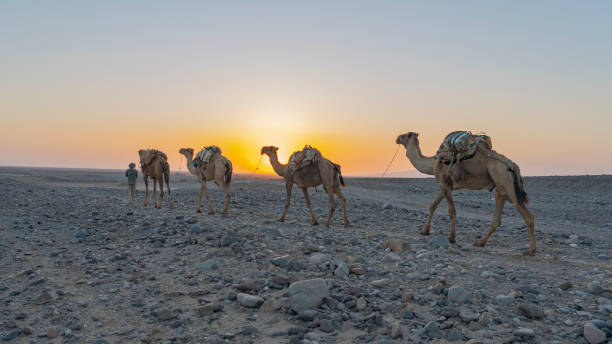
An Afar man leading a caravan of dromedaries transporting salt in the Danakil Depression in Ethiopia in Africa during winter season.
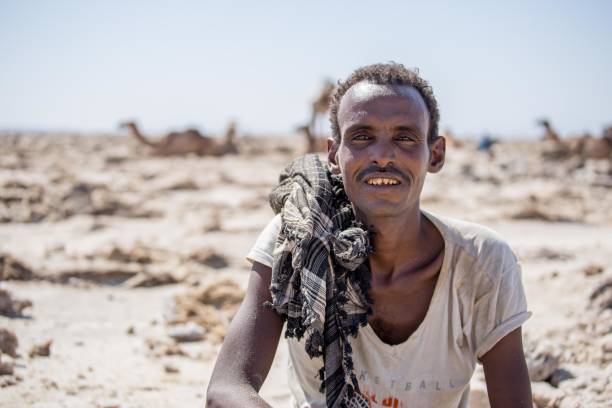
An ethnic Afar salt miner posing with his sharpened teeth in Ethiopia's Danakil Depression
The volcanic explosion crater of Dallol in the Danakil Depresseion in Nothern Ethiopia. The Dallol crater was formed during a phreatic eruption in 1926. This crater is known as the lowest subaerial vulcanic vents in the world. The surreal colours are caused by green acid ponds and iron oxides and sulfur.
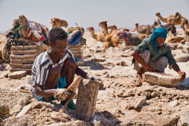
Afar Region, Ethiopia - January 03, 2019: People working in a salt mine in the desert trying to get out salt from the ground and put it in little packs while the camels are resting on a hot day in Afar Region, Ethiopia.
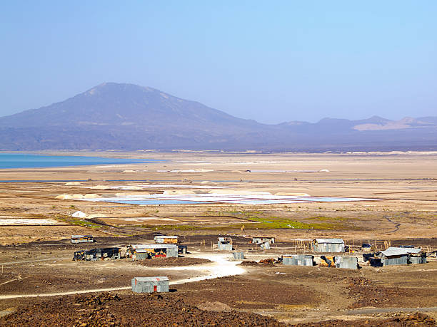
Road to Hamedela in the Danakil Depression in Ethiopia in Africa.
Minerals come up through the ground to stain these bizarre salt formations.
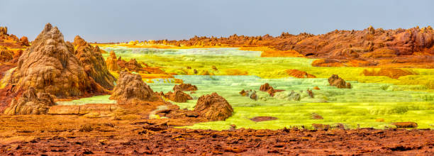
Colorful incredible abstract apocalyptic landscape like moonscape of Dallol Lake in Crater of Dallol Volcano, Danakil Depression, Ethiopia
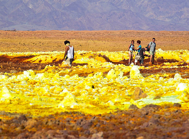
"Tourists walking at fragile Dallol crust as part of Volcanic remains after 1926 eruption of Dallol volcano. It is like Hot Springs with geothermal and volcanic activity with characteristic white, yellow and red colours from sulphur and potassium salts coloured by various ions. It is located in the Danakil Depression with the highest average temperatures on the planet and is considered the most remote and beautiful place on Earth, North East Ethiopia near Eritrea in Africa."
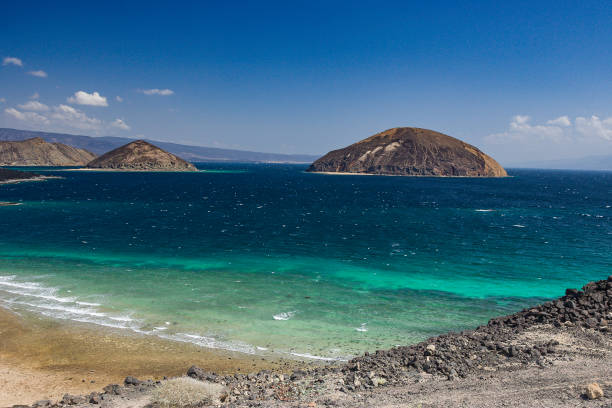
View on the Gulf of Tadjoura with Guinni Koma the Devils Rock, Djibouti, East Africa
The volcanic explosion crater of Dallol in the Danakil Depression in Northern Ethiopia. The Dallol crater was formed during a phreatic eruption in 1926. This crater is known as the lowest subaerial vulcanic vents in the world. The surreal colors are caused by green acid ponds and iron oxides and sulfur.